
Thirty miles into an Alpine valley between Innsbruck and Milan, your tablet's data connection drops. The moving map freezes. Traffic symbols vanish. You're threading between peaks at 8,000 feet in a single-engine Cessna, and the digital situational picture you've been relying on just went blank.
This isn't a hypothetical. According to EASA traffic data, over 40% of European GA flights operate partially in areas with limited ground-based connectivity, including mountainous regions, rural airstrips, and sparsely populated countryside. The FAA's ADS-B Safety Assessment found that lack of continuous traffic awareness is a contributing factor in roughly 18% of mid-air conflicts reported in uncontrolled airspace. Connectivity gaps are a real operational problem, not a minor inconvenience.
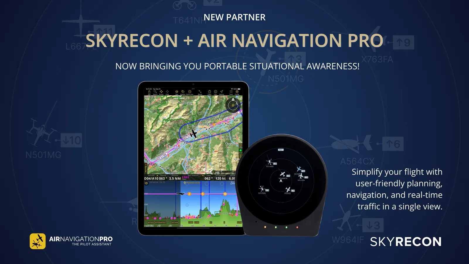
SkyRecon was engineered specifically for these scenarios. Its advanced internet integration blends offline ADS-B and SafeSky feeds with live online updates, ensuring pilots maintain situational awareness even when networks are unreliable. The approach is simple: any traffic and environmental data previously received, either via ADS-B broadcasts or downloaded from SafeSky's network, remains visible even when the device temporarily loses internet access. Once coverage is restored, SkyRecon synchronises with live feeds, filling in gaps in real time and updating alerts automatically.
Navigating Without Gaps
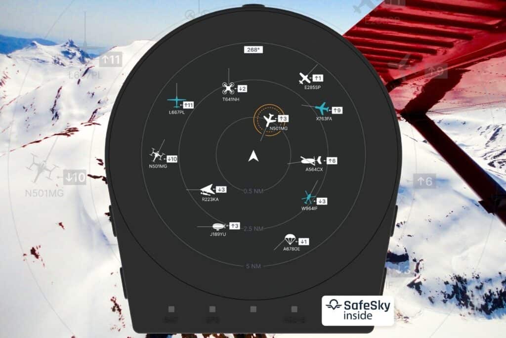
Consider that Innsbruck-to-Milan flight again. As you climb through a shadowed Alpine pass and cellular signal drops, SkyRecon's display continues to show nearby aircraft, altitude differentials, and predicted flight paths. The data doesn't vanish just because the cell tower is behind a ridge. Once you clear the pass and coverage returns, the system synchronises seamlessly, no manual refresh, no lost context.
This continuous awareness matters because the alternative is stressful. Without real-time updates, spotting converging traffic or newly issued NOTAMs becomes purely reactive, limited to visual scanning and radio calls. Both are essential skills, but they have clear limits: line-of-sight constraints, weather interference, high cockpit workload, and the simple fact that not every aircraft makes radio calls.
By ensuring that critical awareness is never lost, SkyRecon transforms regions of intermittent connectivity from a potential hazard into a manageable part of flight planning. As one GA pilot described on a popular forum: "Flying the Alps without coverage used to feel like blindfolded navigation. With a device that keeps updating even in the gaps, I can climb, turn, and descend with confidence, knowing nothing is sneaking up on me."
Built for Connectivity: SIM Tray and Lightweight Bandwidth
A standout feature that sets SkyRecon apart from other portable ADS-B receivers is its built-in SIM tray. This allows the device to access the internet directly, independent of tablets, smartphones, or secondary devices. Pilots no longer have to rely solely on their EFB's data connection or nearby cellular hotspots. The device itself maintains a dedicated, stable link to online services.
In practice, this means SkyRecon continuously receives traffic updates and positional data from SafeSky's network even when a tablet's connection drops or when the aircraft passes through areas with poor coverage. This is particularly valuable over the Alps, the Scottish Highlands, the Pyrenees, or any of the rural corridors where signal interruptions are routine.
SkyRecon is also engineered for efficient, lightweight bandwidth use. Unlike many connected devices that require high-speed internet, SkyRecon only pulls the essential data it needs: traffic positions, altitude information, and SafeSky feed updates. Even a weak cellular signal is sufficient to keep the system fully operational. This is crucial for pilots operating in rural areas, cross-border flights, or low-population regions where connectivity is traditionally limited.
The combination of direct internet access and data-efficient design means pilots can stay informed without worrying about dropped connections, excessive data consumption, or missing critical updates. Areas that were previously blind spots become zones of continuous situational awareness.
Real-World Benefits for GA Pilots
For pilots flying light aircraft, microlights, or rental planes, consistent access to traffic and positional information can be the difference between a routine flight and a high-stress scenario. A private pilot navigating a low-wing Cessna over the Pyrenees faces patchy mobile coverage and unpredictable data links. Without real-time updates, spotting converging traffic becomes a reactive exercise, increasing cognitive load at exactly the moment when the terrain demands full attention.
The statistics reinforce why this matters. According to the 2022 EASA Annual Safety Review, mid-air collisions remain one of the top three causes of fatal GA accidents in Europe, often in uncontrolled airspace where electronic visibility is limited. FAA data shows that aircraft equipped with ADS-B In systems experience an estimated 50% reduction in the likelihood of mid-air conflict compared to unequipped aircraft. Access to real-time, uninterrupted data significantly improves pilot decision-making and flight safety.
SkyRecon addresses these challenges by continuously feeding live traffic, weather, and SafeSky network data directly into the cockpit display, supplementing ADS-B broadcasts. Even when internet or cellular coverage is intermittent, previously received information remains visible, and the device automatically synchronises as soon as connectivity resumes. Pilots maintain a comprehensive, up-to-date picture of their surrounding airspace, reducing uncertainty and enabling proactive decisions.
This multi-source data approach, combining ADS-B with supplemental traffic sources like FLARM and OGN via SafeSky, is what makes the traffic picture robust enough to trust even in remote terrain.
Seamless Integration with Flight Apps and Data Sources
SkyRecon's internet integration works with leading electronic flight bag applications, including ForeFlight, SkyDemon, and EasyVFR. Pilots can overlay ADS-B traffic and SafeSky network data directly onto the familiar maps and flight planning interfaces of their tablet or EFB, creating a single, coherent situational picture. A pilot flying through congested airspace near a busy training aerodrome can see nearby aircraft icons, their altitudes, predicted flight paths, and SafeSky alerts all on the same screen as their navigation charts and approach plates.
The system maintains consistency even in challenging connectivity scenarios. As a pilot transitions from urban airspace with strong cellular coverage to remote mountain valleys or sparsely populated farmland, the EFB continues to display the most recently received ADS-B and SafeSky data. Once the connection is restored, SkyRecon automatically synchronises, filling in gaps without manual intervention. Pilots are never left guessing about nearby traffic or weather hazards, even when networks fluctuate mid-flight.
This integration also reduces cognitive workload by presenting multiple data sources in a single interface. Instead of toggling between separate devices or apps, the pilot can see ADS-B In traffic, SafeSky positional feeds, and flight plan data simultaneously. That streamlines decision-making and improves safety, particularly in complex airspace or during high-workload situations like circuit operations, cross-country flights, or encounters with unexpected weather.
Understanding how these layers fit into the broader electronic conspicuity landscape helps pilots make informed decisions about what tools to carry in the cockpit.
Consistent Awareness, Less Stress
Flying in regions with intermittent or patchy network coverage, whether mountainous terrain, rural landscapes, or cross-border European airspace, no longer needs to compromise safety or situational awareness. SkyRecon's built-in SIM tray provides direct internet access, allowing the device to maintain a stable connection independent of tablets or secondary devices. Combined with intelligent offline/online data blending, pilots continue to receive critical traffic, weather, and positional information even when cellular or airborne networks are temporarily unavailable.
The system operates efficiently, requiring minimal bandwidth while still delivering essential updates. ADS-B traffic and SafeSky network feeds are continuously displayed and automatically synchronised once connectivity resumes, filling data gaps without pilot intervention. Even in remote areas where traditional connectivity is unreliable, pilots maintain a complete, real-time picture of their surroundings.
SkyRecon's seamless integration with ForeFlight, SkyDemon, and EasyVFR further enhances this continuity. Pilots can overlay ADS-B and SafeSky data directly onto their flight maps, keeping all relevant situational information in a single interface. Whether navigating a busy circuit, climbing through mountain valleys, or flying cross-country over rural airspace, the system keeps pilots informed, reduces mental workload, and supports proactive, confident decision-making.
Connectivity challenges become just another variable to manage, not a source of stress. And that's the point: fly with full situational awareness, even in the most challenging environments.
See SkyRecon's full feature set